Curriculum
Course Description
The University of Missouri Geology Field Camp is a 6-week, 6-credit capstone field course for students majoring in geology or related fields. Through a thorough investigation of the geology of the Rocky Mountains centered in western Wyoming, students will develop skills in assessing the geologic history, materials, resources, and active processes of a region. Additionally, students will be exposed to and develop proficiency in the essential field methods in traditional and applied geoscience research.
Subject Areas
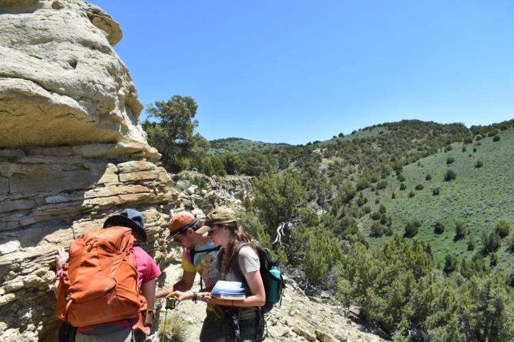
Regional Geology: Evaluate the geologic history and evolution of the Northern Rocky Mountains through a hands-on investigation of their stratigraphy and landforms.
Stratigraphy: Develop the skills to describe detailed stratigraphic variation and analyze sedimentary facies and past environmental change.
Mapping: Learn to create geologic maps from scratch using both traditional field methods and new technologies, such as digital data collection and high-resolution digital elevation models.
Field Trip: Explore some of the most dramatic and unique geologic environments through this 4-day camping trip through the Wyoming Fold and Thrust Belt, Grand Teton and Yellowstone National Parks.
Environmental Geology Projects: Round out your toolbelt through in-depth and hands-on projects in applied and environmental geology projects designed to expose you to common and specialized methods in geoscience research and professional practice.
- Environmental Hydrogeology: Explore diverse methods in physical hydrology, soil science, and geochemistry by examining the shallow hydrogeology of pristine and impacted drainage systems.
- Shallow Geophysics: Collect and analyze geophysical data to reveal shallow structures and inform surface processes and geologic mapping. Methods include seismic reflection, seismic refraction tomography, and electrical resistivity tomography (ERT).
- Subsurface Basin Analysis: Use industry-standard techniques (e.g., well log analysis, sequence stratigraphy) to analyze the composition, structure, and architecture of sedimentary basins to assess their origin, varying environments, and reservoir characterization.
Learning Objectives
Upon completion of this course, students will be able to:
- Evaluate regional stratigraphy using direct observation.
- Measure, describe, and interpret stratigraphic section to understand geologic history.
- Design and implement a strategy for field data collection to solve a geological problem.
- Create a geologic map interpretation of an area to evaluate geologic and tectonic history.
- Relate local geologic interpretations to regional geologic history and events.
- Collect and analyze data in methods common to applied geoscience practice, such as shallow geophysics, hydrogeology, and basin analysis.